How to Read a Topographical Map to Predict Drainage Issues
I still remember the sinking feeling in my stomach when I watched water pool around the foundation of my first DIY home addition. It was a clear sign I had missed something crucial — the subtle signs hidden on that topographical map I’d hastily glanced at. That realization hit me hard: understanding terrain isn’t just for landscape architects; as a builder or homeowner, it’s your secret weapon against drainage issues that can blow your budget and delay your project.
Why Ignoring Topographical Details Might Cost You Big
Imagine pouring concrete, only to discover water seeping into your basement months later. Frustrating, isn’t it? Well, much of these problems trace back to how well you read and interpret your site’s topography. Over the years, I’ve learned that a topographical map is like a secret diary of the land — revealing slopes, depressions, and natural drainage paths that are critical for a successful build. If you overlook these subtle cues, you risk misplacing drainage systems, leading to erosion, flooding, or foundation cracks.
> Did you know that according to the Environmental Protection Agency, proper site grading can reduce runoff pollutants by up to 90%? That’s a staggering fact that underscores the importance of reading terrain correctly from the start.
Is this something you’ve faced — rushing into a project and realizing too late that the land doesn’t drain the way you thought? If so, keep reading. We’re about to dive into how a careful analysis of topographic maps can save you from future headaches and costly repairs.
Is every topographical map created equal in predicting drainage issues?
Early in my journey, I made the mistake of trusting outdated or overly simplified maps, which painted a picture that was almost too good to be true. I didn’t realize that terrain can change significantly over short distances and that seasonal variations can obscure drainage patterns. This experience taught me to scrutinize maps carefully and use multiple sources for cross-verification. It’s also worth noting that terrain features like natural slopes and soil types play a vital role in drainage — factors that sometimes get lost in the digital clutter.
If you’re feeling overwhelmed or skeptical about the role of topographical analysis, remember that mastering this skill is a game-changer. For tips on creating accurate site plans and understanding terrain better, visit our guide on [navigating permits](https://constructionedgez.com/navigating-permits-a-step-by-step-approach-for-builders), which emphasizes the importance of thorough site analysis.
So, before you break ground, let’s explore how to interpret topographical maps effectively, ensuring your project is built on solid ground — literally and figuratively.
Begin with Accurate Site Surveys
Start by conducting a thorough site survey, preferably with a professional land surveyor or using high-resolution drone mapping if you’re confident in your skills. This step provides precise elevation data and reveals subtle land features that maps might miss. I once rushed this step and overlooked a minor slope transition, which later caused drainage issues during heavy rains. The lesson? Never underestimate the importance of real-world data over just digital maps.
Cross-Verify Topographical Data Sources
Gather topographical maps from multiple sources like county GIS departments, online soil and terrain databases, and local planning offices. Look for consistency among these sources; discrepancies often highlight seasonal changes or outdated information. When I cross-referenced an online map with local survey data, I discovered a seasonal pond that could influence foundation planning. This step ensures you’re working with the most reliable data, reducing surprises down the line.
Interpret Land Slopes and Drainage Paths
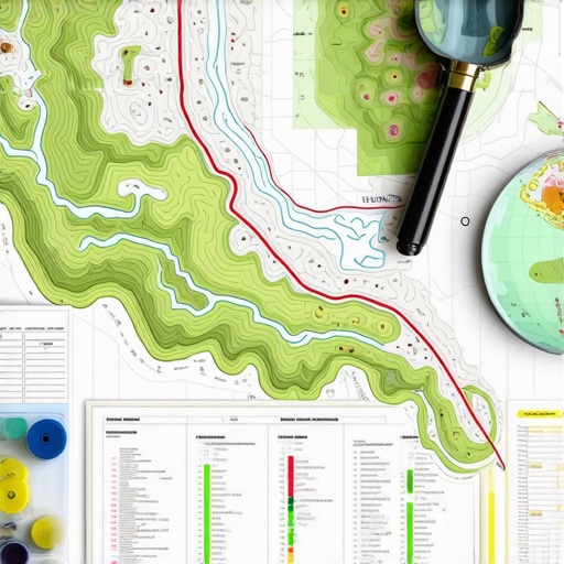
Visualize how water naturally flows across your site by analyzing contour lines. Imagine the land as a rollercoaster—water flows downhill, following the simplest path. Identify natural depressions and high points to predict where water will accumulate or run off. I once designed a drainage plan by tracing contour lines and found a natural slope directing runoff away from the foundation. I then designed swales and drain tiles along these paths, saving thousands in future waterproofing corrections.
Identify Critical Soil and Subsurface Features
Beyond surface topography, examine soil types and subsurface conditions. Conduct soil tests to determine permeability, compaction, and the presence of clay or sand. These factors influence drainage and foundation stability. I learned this the hard way when a site with high clay content retained water, causing frost heaving. Incorporate soil reports into your site analysis to adapt your drainage and foundation strategies effectively.
Implement a Strategic Drainage Plan
Based on your topographical insights, design a drainage system that directs water away from your structure. Use swales, french drains, or permeable paving where appropriate. For my project, I created a swale along the downhill edge of the property, linked it to a dry well, and graded the lawn to slope gently away from the foundation. This proactive approach prevents water intrusion, foundation settling, and erosion, which could significantly inflate project costs.
Document and Validate Your Findings
Maintain detailed records of your topographical data, soil reports, and drainage designs. Cross-check with local codes and regulations by consulting [navigating permits](https://constructionedgez.com/navigating-permits-a-step-by-step-approach-for-builders), ensuring compliance. Sharing your findings with engineers or landscape architects enhances accuracy and safeguards your project. My experience taught me that proper documentation expedites permitting and prevents costly revisions later.
Refine Plans with Professional Input
Finally, collaborate with qualified professionals—geotechnical engineers, civil engineers, or landscape architects—to review your analysis. They offer insights to optimize your drainage layout and foundation design further. During my last addition project, involving a local engineer uncovered a hidden underground utility line, saving me from potential delays or violations. Incorporate their expertise early to avoid undermining your site’s stability and drainage integrity.
Many homeowners and even seasoned builders often fall prey to misconceptions that cost time and money during new construction or renovations. Contrary to popular belief, the biggest pitfalls are rarely obvious errors; instead, they are subtle nuances that can derail a project if overlooked.
One common myth is that estimating costs is straightforward—simply adding up material and labor. However, the reality is more complex. Efficiently managing budgets requires understanding the intricacies of scope creep, hidden costs, and fluctuating prices. Exploring advanced estimating techniques, like those discussed in [cost-effective estimating methods](https://constructionedgez.com/cost-effective-estimating-techniques-for-new-builds-and-additions), can reveal potential budget pitfalls early, saving you from unpleasant surprises.
Another trap is underestimating permit complexities. Many assume permits are mere bureaucratic hurdles, but in truth, permit requirements can significantly influence project timelines and scope. For instance, failing to account for specific local regulations or upcoming code changes, like the changes in permit requirements in 2025, can cause costly delays. Familiarity with proper permit navigation—detailed in [permit acquisition tips](https://constructionedgez.com/navigating-permits-a-step-by-step-approach-for-builders)—is essential for smooth project progression.
Speaking of permits, a critical yet often ignored nuance is the timing and documentation process. Incomplete or improperly submitted applications can lead to rejection or demand for re-submission, adding weeks or months to your timeline. Also, understanding the difference between permit fees and impact fees helps prevent budget miscalculations. More insights on these topics are available in [the complete guide to permitting](https://constructionedgez.com/the-complete-guide-to-permitting-for-new-builds-and-additions).
When it comes to new builds and additions, many overlook the importance of detailed site analysis. Advanced site planning involves assessing not just topography but also subsurface conditions and existing utilities—a process that, if neglected, can cause foundation failures or utility conflicts. For example, missing a hidden underground utility or misjudging soil bearing capacity can lead to expensive redesigns. To avoid this, collaborate with experts and leverage tools like 3D landscape models, which help catch drainage errors before they become costly mistakes.
Finally, a less obvious but impactful factor is the project management process itself. Beginners often underestimate the importance of continuous oversight and documentation. Implementing a structured approach—covering everything from material orders to inspection records—ensures that issues are identified early and resolved efficiently. Resources like [managing additions from planning to execution](https://constructionedgez.com/efficiently-managing-additions-from-planning-to-execution) offer detailed strategies.
In summary, the true secrets to successful new builds or additions lie in paying attention to these subtleties—rigorous estimation, thorough permit understanding, precise site analysis, and proactive project management. Have you ever fallen into this trap? Let me know in the comments.When it comes to keeping your build in top shape over the years, the right tools can make all the difference. Personally, I swear by high-quality laser levels like the Leica D210, which offers incredible accuracy for site alignment and grade checks. It ensures my foundation remains true, even as soil settles or weather fluctuates. Additionally, I integrate drone-based mapping using platforms like DroneDeploy, which provides detailed topographical updates over time—helpful for proactive drainage management and site planning. These tools save hours on manual surveys and offer data precision that simply can’t be matched by traditional methods. As technology advances, I predict an increased reliance on 3D modeling software like SketchUp and structural analysis tools such as RAM Structural System, streamlining long-term maintenance planning and scalability assessments. How do I maintain these tools over time? Regular calibration is key—laser levels, for example, require annual calibration checks with certified technicians to stay within manufacturers’ specifications. Also, firmware updates for drones and software can enhance features and fix bugs, prolonging their effectiveness. Investing in protective cases and proper storage extends the lifespan of delicate equipment, reducing costly replacements. For instance, protecting your drone from dust and impacts ensures you get reliable site scans for years to come. Don’t forget to keep detailed logs of maintenance schedules and calibration dates; this helps identify when a device might need professional servicing before inaccuracies compound. Remember, as Mike Holt from Electrician’s Handbook asserts, “Regular maintenance and calibration of tools are foundational to safety and precision in construction.
A Few Hard-Won Truths About Site Planning That Changed My Approach
One of the toughest lessons I’ve learned is that revisiting and questioning my initial site analysis paid dividends. I once designed a foundation based solely on surface topography, only to realize later during excavation that unseen underground pipes and soil inconsistencies would complicate drainage. That experience reinforced the importance of comprehensive soil testing and cross-verifying maps from various sources—something I wish I had prioritized from the start. The moment I shifted to integrating detailed soil reports and visualizing water flow became a turning point in my projects.
Strategies That Transformed My Permit Navigation
Early in my career, I underestimated the complexities of permit requirements and their timing. I used to see permits as mere formalities, but fast forward to countless delays and rejections taught me otherwise. Now, I proactively review permitting guides like the complete permit acquisition guide, and involve professionals early to ensure compliance. This shift has saved me weeks—and sometimes months—by preventing oversights and streamlining approvals.
Simple Adjustments That Prevent Major Drainage Headaches
It took me a project where poor grading and overlooked natural slopes caused basement flooding to realize that strategic site modifications make all the difference. I learned to create detailed drainage plans early, utilizing contour line analysis and designing swales and French drains accordingly. Implementing these small, thoughtful adjustments saved thousands in waterproofing and foundation repairs, proving that paying attention to terrain nuances is non-negotiable for durable, cost-effective builds.
My Go-To Tools for Building Confidence in Site Accuracy
Over the years, investing in high-quality laser levels like the Leica D210 and drone mapping platforms such as DroneDeploy revolutionized how I verify site conditions. These tools’ve enhanced the precision of my grading and drainage layouts, ultimately saving time and boosting project quality. Regular calibration and thoughtful data management are crucial to maximizing their benefits. My suggestion? Embrace these technologies—they’re worth every penny for more confident project execution.
Your Next Move in Building Smart and Safe
Embrace the lessons from my journey—invest in thorough site analysis, leverage the right tools, and respect the permit process, and you’ll build stronger, more resilient structures. Remember, the key to successful new builds and additions is not just about hard skills but also about the awareness of subtle land features and compliance nuances. As you step forward, challenge yourself to go beyond surface-level assumptions and create plans rooted in detailed insights. Your carefully considered approach will pave the way for projects that stand the test of time and weather.