How 3D Landscape Models Catch Drainage Errors Before You Dig
How 3D Landscape Models Catch Drainage Errors Before You Dig
When most homeowners and developers envision a new outdoor space, they see the vibrant blooms of a drought tolerant landscape design, the sleek lines of a modern deck, or the inviting glow of a fire pit. However, as any seasoned professional in the construction industry will tell you, the most beautiful landscape is a liability if it hasn’t been engineered to handle water. While the “pretty” side of online landscape design captures the imagination, the most critical work happens beneath the surface. In the past, drainage planning was often left to two-dimensional blueprints and the “gut feeling” of a contractor on-site. Today, the advent of 3D modeling has revolutionized how we approach site preparation.
The stakes of getting drainage wrong are incredibly high. A minor miscalculation in grade can lead to water pooling against a foundation, causing thousands of dollars in structural damage. By utilizing 3D landscape design services, project owners can now visualize the invisible: the flow of storm water, the intersection of underground utilities, and the precise pitch of every paved surface. This proactive approach identifies catastrophic errors before a single shovel hits the dirt, transforming the design process from a gamble into a calculated science.
The Financial Nightmare of Drainage Failures
The cost of ignoring drainage during the design phase is staggering. Research and industry data suggest that fixing backyard drainage issues after construction is complete typically costs between $150 and $10,000, depending on the severity. However, if the error involves serious land grading issues or the replacement of a collapsed or improperly pitched pipe section, homeowners often face bills between $3,000 and $8,000 just for the remedial earthwork. These figures do not include the collateral damage to the home itself.
When water is not directed away from a structure, it can lead to hydrostatic pressure buildup against basement walls, resulting in cracks, mold, and rot. An online landscape architecture approach is significantly cheaper than hiring a backhoe for emergency repairs. For instance, a small French drain installed proactively during the initial build might cost a mere $500. In contrast, emergency foundation repairs triggered by poor drainage can easily exceed $6,000. By investing in a comprehensive online landscape design company, you are essentially buying an insurance policy against the most common cause of exterior construction failure.
Furthermore, the environmental impact of poor drainage – such as erosion that strips away expensive topsoil or runoff that carries pollutants into local waterways – can lead to municipal fines. Utilizing digital landscape design ensures that water is managed on-site according to local regulations, preventing these hidden costs from surfacing years after the project is “finished.”
How 3D Modeling Visualizes Water Flow
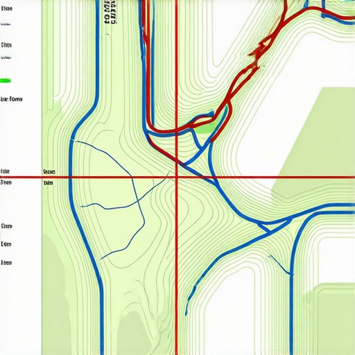
Traditional 2D site plans use contour lines to represent elevation, which can be difficult for anyone but a civil engineer to interpret accurately. 3D modeling software, such as Civil 3D or VizTerra, takes this data and creates a “slope analysis display.” This tool generates a heat map of the terrain, where different colors represent varying degrees of steepness. This allows designers to instantly identify “flat spots” or depressions where water will inevitably pool.
One of the most common errors in patio construction is failing to account for the necessary “pitch.” You can learn more about the technical requirements in our guide on the specific drainage slope required for exterior patios. In a 3D model, we can simulate a rain event and see exactly where the water travels. If the model shows water migrating toward the home’s sliding glass door rather than the lawn, we can adjust the digital grade in seconds. In the real world, that same adjustment would require days of re-excavation and new materials.
This visualization is particularly vital for complex sites with multiple levels. A digital landscape design can calculate the cumulative volume of water moving from an upper terrace to a lower garden bed, ensuring that the lower level isn’t overwhelmed. This level of precision ensures that every retaining wall and staircase acts as a conduit for water management rather than a dam.
Clash Detection: Avoiding Buried Infrastructure
Drainage isn’t just about the surface; it’s about what lies beneath. One of the most powerful features of 3D landscape design services is “clash detection.” This process involves layering the proposed landscape elements – such as irrigation lines, drainage pipes, and footings – over the existing utility map. This prevents the “oops” moment where a contractor strikes a gas line or discovers that a new drainage pipe cannot clear an existing sewer main.
Before breaking ground, it is essential to perform due diligence. We highly recommend reviewing how to check for buried fuel tanks before breaking ground to avoid environmental catastrophes. A 3D model can incorporate data from ground-penetrating radar to show exactly where these obstacles sit in three-dimensional space. This allows the designer to reroute drainage systems digitally, ensuring they maintain a consistent downward slope without intersecting other buried assets.
Additionally, 3D modeling helps navigate the legalities of the land. For example, understanding the setback conflict between fences and easements is much easier when you can see the easement boundaries represented as “virtual walls” in your design. This prevents the common error of placing a heavy drainage basin or a permanent fence over a utility access point, which would eventually lead to forced removal by the city.
Specialized Applications: From Decks to Ranches
The utility of 3D modeling extends across all types of property development. Whether you are working with an online deck designer or planning a massive agricultural project, the principles of digital water management remain the same.
Residential Decks and Additions
During backyard deck construction, drainage is often overlooked because the surface is permeable. However, water that falls through deck boards can saturate the ground around the footings, leading to frost heave or settling. A 3D model helps designers plan for under-deck drainage systems. It also ensures that the footings themselves are engineered correctly; for example, understanding why your addition footings need rebar chairs for proper support is critical when the soil is prone to high moisture content. Furthermore, if your design includes an enclosed space or a basement addition, you must account for mechanical drainage, such as why your addition requires a dedicated circuit for the sump pump, which can be mapped out within the 3D electrical and plumbing overlay.
Large-Scale and Commercial Projects
For expansive properties, a ranch landscape design requires sophisticated water catchment and swale planning to prevent soil erosion across hundreds of acres. 3D models allow for “watershed modeling,” predicting how water will move across vast topographic changes. Similarly, in a commercial setting, such as a restaurant patio design, drainage is a matter of safety and liability. Standing water on a commercial patio is a slip hazard and can deter customers. 3D modeling ensures that large paved areas are perfectly pitched toward hidden slot drains, maintaining the aesthetic while ensuring guest comfort.
Regulatory Compliance and Permits
Modern municipalities are becoming stricter regarding how much water a property can shed onto the street or neighboring lots. This is governed by the “Impervious Surface Ratio.” When you use an online landscape design service, the software can automatically calculate the square footage of non-porous surfaces like concrete and stone. Understanding the impervious surface ratio that limits your paved patio size is vital for getting your permits approved on the first try.
Moreover, if your project involves significant grade changes, the city will likely require a drainage plan. A 3D model can be exported as a professional grading plan that shows exactly how the land will be shaped to handle runoff. This is especially important for retaining walls; you should consult our resource on why your retaining wall plan needs a drainage map. Without this data, walls can fail under the weight of water-saturated soil, a disaster that 3D modeling is specifically designed to prevent.
Conclusion: The Value of Digital Foresight
In the modern construction landscape, 3D modeling is no longer a luxury reserved for skyscrapers and highway interchanges. It is an essential tool for any homeowner or developer who wants to ensure their investment is protected. By catching drainage errors in the digital phase, you avoid the physical and financial pain of remedial construction. 3D landscape models provide a level of “digital foresight” that 2D plans simply cannot match, allowing you to see exactly how water, utilities, and structures will interact on your unique piece of land.
Before you break ground, ensure your project has been vetted by an online landscape design company that prioritizes engineering as much as aesthetics. Whether you are building a simple garden path or a complex multi-level commercial space, the “measure twice, cut once” adage has been upgraded to “model once, dig once.”
Ready to start your project with precision? Contact the experts at landscapedesignogden.com for a comprehensive 3D design consultation, or visit the Contact Us page on Construction Edgez for professional project management advice to ensure your next build is a success.