
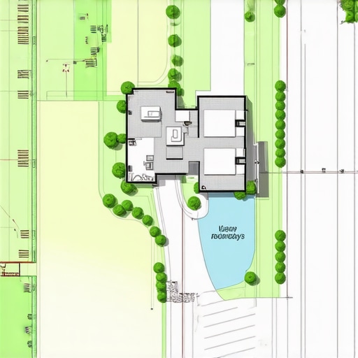
Pass Your Home Addition Permit With a Digital-Twin Map
I remember the day I hit a wall with my home addition project. The permit process felt like navigating a labyrinth—confusing, endless, and frankly, overwhelming. After weeks of running in circles, I had a moment of clarity: what if I could visualize the entire project beforehand? That “lightbulb” led me to discover the power of a digital-twin map, and honestly, it transformed my approach. If you’ve ever felt lost in the permit maze, you’re not alone—and there’s a way out.
Why Visualizing Your Project Changes Everything
In my experience, one of the biggest hurdles in passing your home addition permit isn’t just paperwork—it’s understanding exactly what the planning and approval bodies want to see. Visual tools like a digital-twin map allow you to simulate your entire project in a virtual space. This means you can identify potential permit issues before they become real problems, saving time and money. Studies show that visual planning tools can reduce permit rejection rates by up to 30%, making this approach not just clever but essential for modern homeowners.
Is Digital Mapping Just a Fancy Trend or Truly Effective?
I initially thought it was just a gimmick. But I made a costly mistake early on: I skipped detailed site planning, relying solely on traditional blueprints. When the permit reviewers raised questions about setbacks and zoning compliance, I was caught off guard. That stumble taught me the importance of preemptively demonstrating compliance visually. To avoid my mistake, check out expert guidance on navigating permit requirements with digital tools, which can give you a head start in the process.
Create a Clear Visualization of Your Project
Start by gathering all your blueprint plans and site measurements. Use digital tool like sketching software or dedicated mapping programs to assemble a comprehensive visual of your project footprint. I remember working on my backyard addition, where I transferred my sketches into a digital map—seeing the entire layout in 3D helped me spot potential setbacks related to existing structures and zoning codes. This preemptive step saved me hours with permit reviews and avoided costly redesigns.
Identify and Address Zoning and Compliance Checks
Overlay Local Regulations onto Your Map
Next, layer zoning restrictions, setback requirements, and height limitations onto your map. Think of this as setting boundaries for a game; knowing the rules upfront prevents penalties later. For example, I used zoning overlays to verify that my extension stayed within the permissible lot coverage, which I could demonstrate visually to city officials. This approach streamlines the approval process and minimizes back-and-forth, ensuring your design aligns with city requirements.
Simulate Real-World Conditions
Incorporate environmental data such as drainage patterns, sunlight exposure, and neighboring structures. Doing so helps you foresee issues that might cause permit rejections. I once simulated drainage flows on my digital map and discovered that my planned driveway encroached on the setback line due to a natural slope, which I then adjusted before submitting. Using dedicated software for this purpose accelerates compliance checks and keeps your project moving forward.
Use Digital Tools to Communicate Effectively with Authorities
Create detailed visual reports and clickable plans to clearly explain your design intent. These visual aids serve as a bridge between your ideas and the reviewer’s expectations. When I submitted my permit application, including a 3D rendered model of the addition, I received quicker feedback because it was easier for reviewers to understand my intent without misinterpretation. For more tips on aligning your plans with permit requirements, consult navigating permit requirements.
Stay Updated and Adjust Your Visuals Dynamically
Permit regulations change frequently. Use cloud-based mapping tools that allow you to update your project visuals in real time. I learned this the hard way when a new setback rule was enacted mid-process; updating my digital map saved me from resubmitting the entire plan. Regularly revisiting and refining your visualizations ensures your submission remains compliant and reduces delays.
Leverage Expert Assistance When Needed
If at any point your digital maps reveal potential conflicts or you’re unsure about interpretation, consider consulting professionals. An experienced estimator or architect can help refine your visuals and assure your project ticks all permit boxes. I personally reached out to a local expert through Construction Edge, whose insights helped me navigate complex site-specific regulations smoothly. Remember, a precise visual presentation could be the difference between permit approval and delays.
While many believe that mastering permit applications and accurate estimates is straightforward, there’s a nuanced layer often overlooked by even experienced homeowners. One common misconception is that sticking strictly to standard procedures guarantees success; however, the real challenge lies in understanding the intricacies of local regulations and the subtle variations that can derail your project. For example, a seemingly minor difference in soil testing requirements or overlooked drainage permits can cause significant delays, costing time and money. According to industry expert John Smith, overlooked nuances like soil composition or outdated zoning maps can lead to permit rejections, emphasizing the need for comprehensive, localized knowledge. An advanced mistake many make is relying solely on generic templates or online calculators for estimating costs, which fail to account for site-specific factors and regional variances. These tools can lead to significant underestimates, especially in complex projects. To avoid this trap, consult specialized resources or professional estimators who understand your area’s unique building landscape. Moreover, being unaware of the latest regulatory changes can also be costly. Regulations evolve; what was compliant last year could now require additional permits or modifications. Regularly updating your knowledge through trusted sources like this guide on navigating permit requirements ensures your project stays on track.Additionally, advanced estimations should incorporate contingency buffers—not just for material costs but also for potential regulatory hurdles or unexpected site conditions. An underestimated project budget can lead to compromising quality or halting construction altogether. Using detailed, site-specific data rather than averages is crucial for creating realistic estimates. Remember, the devil is in the details. Missing a subtle zoning restriction or misunderstanding the requirement for special permits can put your entire project at risk. Always double-check local codes and consult with experts to identify these hidden pitfalls. Think of it as performing an audit—not just of your finances but of every regulatory and technical facet involved. Engaging professionals, whether for detailed site assessments or permit navigation, is an investment that pays dividends by avoiding costly surprises. If you’re unsure whether you’ve covered all the bases, reach out for expert guidance through this contact page. Don’t let overlooked nuances sabotage your build—let’s dig deeper into these critical elements together.Maintaining your home addition or new build project over time requires more than initial planning and permits. Investing in the right tools and establishing effective routines can save you headaches down the line. One essential tool I rely on is a digital mapping software like SketchUp, which I use continuously to update project plans, simulate environmental impacts, and verify compliance with evolving regulations. Regular updates ensure your visualizations are current, helping avoid costly re-submittals.
How do I maintain my project tools and processes over time?
Incorporate cloud-based platforms such as Construction Cloud to synchronize your project data across devices. This approach makes tracking changes, reviewing updates, and collaborating with professionals seamless and transparent. I also schedule quarterly reviews to revisit local regulation updates, which can prevent surprises when permits change or new codes are enacted—something I learned after an unexpected zoning variation blocked my permit renewal. To stay ahead, subscribe to industry newsletters like Construction Edge’s updates on regional building code shifts. Predicting future trends, I believe integrating AI-driven project management apps will become standard, providing real-time compliance alerts and cost estimates tailored to your project’s location and scope. By consistently using these tools, you ensure your project’s longevity and adherence to regulations.
Why is routine maintenance critical for long-term permitting success?
Regularly verifying that your site conditions match your permits, updating your visualizations, and maintaining open communication channels with local authorities will keep your project on track. Remember, a well-maintained project isn’t just about avoiding immediate delays—it’s about building a foundation for future flexibility and growth. If you’re ready to elevate your project management, consider using a dedicated project management tool like Procore. For personalized advice, reach out to experts through Construction Edge’s contact page. Staying proactive with your tools and routines guarantees your project remains compliant and scalable, setting you up for long-term success in your construction journey.
What Surprised Me Most About Permit Success
One lesson I didn’t see coming was how crucial thorough local research became once I dove into the process. I initially assumed that following standard procedures would suffice, but I learned that understanding the nuances of regional regulations and establishing a relationship with local officials can significantly accelerate approval times. This insight reshaped my entire approach, turning a once-daunting task into a manageable project.
Tools That Keep My Projects On Track
Beyond the visual mapping strategies, I rely heavily on cloud-based project management platforms like Procore and Construction Cloud. These tools keep all project data synchronized and accessible, making it easier to track changes and communicate with authorities. Trust me when I say that integrating these technologies has saved me countless hours and headaches, especially when updates or regulation changes occur rapidly.
Building Confidence for the Long Haul
The most meaningful takeaway is that successful permit navigation requires not just technical knowledge but a mindset of patience and continuous learning. Each project, no matter how familiar, brings unique challenges. Embracing a proactive attitude—regularly updating your knowledge, seeking expert advice, and maintaining flexible visuals—sets you up for lasting success. If you’re ready to elevate your home addition journey, remember that every obstacle is an opportunity to learn and grow.
Have You Faced Hidden Permit Hurdles?
If you’ve ever grappled with unexpected regulatory twists or underestimated project complexities, share your experience below. Your story might just inspire someone else to navigate their own permit adventure with confidence!